Steer Home

Main navigation

  • Sectors
    • Transportation
      • Active travel
      • Aviation
      • Freight & logistics
      • Ports & maritime
      • Rail, bus & transit
      • Roads, bridges & tunnels
      • Urban & rural mobility
    • Places & communities
      • Commercial real estate & housing
      • Community planning
      • Economic development & regeneration
      • Education & health
      • Leisure, arts & culture
      • Sports & major events
    • Resources
      • Energy
      • Property & land
      • Telecommunications & data
      • Water
  • Services
    • Advisory & financial
      • Market research & intelligence
      • Demand & revenue forecasting
      • Business & financial modelling
      • Capital programme advice & assurance
      • Project financing
      • Commercial & technical due diligence
      • Economic impact
    • Strategy & policy
      • Policy development
      • Business case & advocacy
      • New technologies
      • Regulation & competition
      • Sustainability & climate resilience
      • Strategy & management consulting
    • Planning, delivery & experience
      • Community engagement
      • Network design & operation
      • Cost modelling & strategies
      • Feasibility design & detailed design
      • Information & wayfinding
      • Infrastructure & development planning
    • Underpinning capabilities
      • Equity & inclusion
      • ESG
      • Data science & analytics
      • Monitoring & evaluation
  • Projects
  • Insights
  • Events
Regions
  • Global
  • North America
  • Latin America
  • Europe
  • UK & Ireland
  • India
Search
Contact
  1. Home
  2. Projects
  3. Developing a wayfinding vision for Regent's University London
Regent's University London, UK

Developing a wayfinding vision for Regent's University London

The Steer design team has worked with Regent’s University London since November 2015 to develop a site-wide wayfinding system. The key objective of the work is to deliver a comprehensive wayfinding system that will improve the visitor and student experience while projecting the University's unique character.

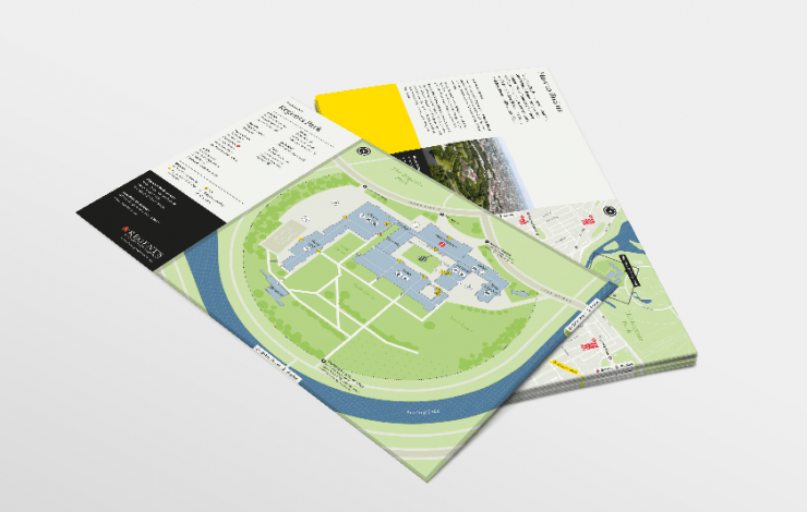
Current deliverables include the design of a user focused campus map for print an online use. The print map works as a tear-off, A4 double sided sheet including a location context map on the reverse highlighting strategic transport connections. In addition to the campus wide map we have also developed internal building plans in order to identity how best to communicate information and the connections to buildings.

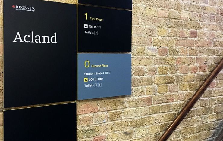
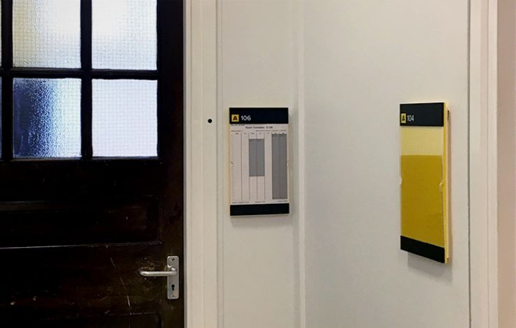
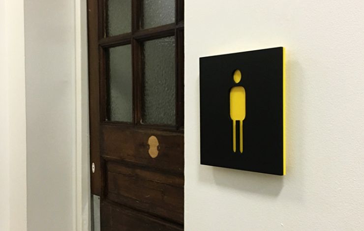
The next stage of the project will be to design and deliver a pilot concept signage system for Acland Building in order to test the system prior to a wider campus roll out.


On
Steer group

We are Steer

Yes, you are in the right place. After 40 years, we have changed our name from Steer Davies Gleave to mark our growing international footprint and our expanding portfolio into sectors beyond transport.

Explore our new website to learn more about Steer: who we are, how we work and what our future holds.

Complex challenges.
Powerful solutions. 

Footer menu

  • Sectors
  • People
  • Services
  • About
  • Projects
  • Careers
  • Insights
  • Contact
  • Events
  • Our impact

©2025 Steer      Legal & policies        Cookie settings

Subscribe to our newsletter

  • Facebook
  • Twitter
  • Linkedin
  • Instagram
  • Spotify

Back to top