Understanding how to build connected homes and communities with Steer’s Planning Reform Story Map
As the new Labour Government eyes its 1.5 million housebuilding target the obvious question is where will these homes go?

As the new Labour Government eyes its 1.5 million housebuilding target the obvious question is where will these homes go? Here we begin our wider series looking at how the UK will build more and better homes by exploring our new Planning Reform Story Map.
Steer is launching a useful resource, our Planning Reform Story Map, to provide data driven insights into changes to the UK’s planning system. This includes a spatial understanding of where in England is most impacted by new targets and where has the greatest potential for new development.
Having run on a platform to ‘Get Britain Building’ the new UK Government has wasted no time in setting out their planning reform agenda. A slew of proposed strategic changes to the National Planning Policy Framework (NPPF) could significantly change the planning landscape. New principles for prioritising locations and forms of development have emerged and include embracing the concept of the ‘grey belt’.
These changes will alter the quantity and distribution of where housing and other developments are located. At Steer, we are assessing the implications of these changes but also asking, how can we prioritise housing development in a way that is connected by high frequency and high-quality sustainable transport and fast, reliable digital connectivity that is agreeable to local communities?
What are the proposed changes to the NPPF and the planning agenda more broadly?
The government is committed to responsible and locally suited development plans and with an eye to resource optimisation seeks to encourage the densification of existing urban spaces. This approach will see the use of land near existing infrastructure, for example railway stations, to avoid urban sprawl, private vehicle reliance and further loss of and damage to the countryside.
Flagship national proposals include:
- reintroduction of mandatory house building targets using a new methodology for target setting;
- prioritising ‘Brownfield’ development, including a shift towards a default "Yes" stance for to accelerate urban redevelopment and repurposing;
- the introduction of ‘Grey Belt’- a redefinition of ‘low-quality’ Green Belt that will open up previously protected space to housing and other development projects;
- the headline grabbing but as-yet-light-on-detail next generation of New Towns with an independent commission appointed of Dame Kate Barker and Sir Michael Lyons to identify principles and locations reporting in the next 12 months;
- reinforcing the need for up-to-date Local Plans and sufficient strategic housing land availability;
- a strengthening of the duty to cooperate; ad
- additional local authority planning officers.
Each of these definitive moves towards home-building and away from NIMBYism carry their own opportunities and challenges for local planning authorities and their communities. Other local and regional bodies, such as local transport and highway authorities, combined authorities, and sub-national transport bodies all have a role to play locally and regionally. How their policies, plans, and strategy flex and adapt will be important for providing an integrated and supportive framework.
Steer’s Planning Reform Story Map
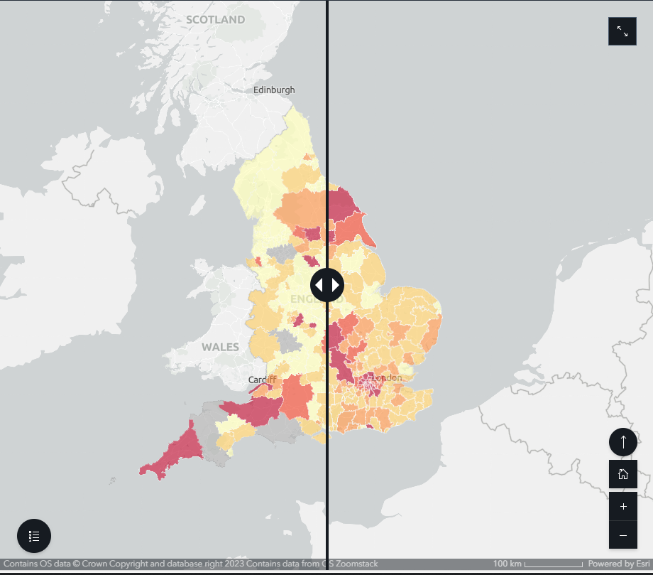
This shift in policy will see some local authorities required to build more homes while others will actually need to build less than planned. Large cities like Manchester and Birmingham remain high under both the current and previous schemes but there are big changes for local authorities in the north east and the south west of England.
To aid understanding of the updated NPPF Steer has created the Planning Reform Story Map, a resource that will be useful for anyone who wants to understand changes to the Government's new housing targets.
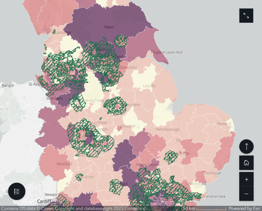
Our approach breaks down the data and works at the intersection of transport and development planning, looking for a macro-level view of how housing priorities could intersect with key factors such as transport and digital connectivity, economy and local service provision, and decarbonisation and natural capital.
Regional actors, such as Sub-National Transport Bodies (STBs), county councils and combined authorities will find the story map particularly useful. So too will private developers looking to better understand connectivity and improve site selection, increasing their chances of getting the green light on proposed residential developments.
Going forward we’ll be delving deeper into this exciting new phase of planning for the UK, including by identifying key corridors for grey belt development to ensure homes are connected to public transit and active travel networks.
At a time when integrated and cross-border planning are on the up our perspective on planning and development has never been more relevant.
View our Planning Reform Story Map here.